
Prof. Dr. Lorenz Hurni: Lorenz Hurni has been Associate Professor of Cartography and director of the Institute of Cartography at the ETH Zurich since November 1996 (Full Professor since October 2003). The emphasis of Hurni's research lies in cartographic data models and tools for the production of printed and multimedia maps. Another focus of research covers interactive, multidimensional multimedia map representations. Under his lead, the prize-winning multimedia "Atlas of Switzerland", commissioned by the Federal Council, as well as the "Swiss World Atlas", the official Swiss school atlas, commissioned by the Swiss Conference of Cantonal Ministers of Education, are being developed.

Dipl. Eng., MSc. Charalampos Gkonos: Charalampos Gkonos is a Research Associate at the Institute of Cartography and Geoinformation at ETH Zurich. He received his Diploma degree in Rural and Surveying Engineering at NTU Athens and his MSc degree in Geomatics at ETH Zurich. His research interests include but are not limited to web-cartography, GIS, HCI, sustainable development and cartographic education. His current work focuses on the dissemination and use of geodata for research purposes within the ETH domain besides teaching and cartographic education. Part of his work has been published in the International Journal of Sustainable Energy Planning and Management, the Journal of Location Based Services and the ISPRS International Journal of Geo-Information. 

Dr. Hans-Rudolf Bär: Hans Rudolf Bär received his PhD in geography from the University of Zurich. In 1995, he joined the Institute of Cartography at ETH Zurich, where he first started work with interactive atlases. Since then, he was in charge with the conception and programming of a number of interactive atlases such as the national "Atlas of Switzerland", the statistical atlas of the European Union (Statlas) and a Web-based school atlas, the "Swiss World Atlas".

Flurin Weber: Flurin Weber is studying in the second semester of the MSc in Geomatics at ETH Zurich. He is 24 years old. He has grown up and gone to high school in a small city in Switzerland called Aarau, before completing his Bachelor’s degree at ETH Zurich. In his free time he likes hiking in the Swiss Alps (where maps are always of great importance) and photography. Moreover, he likes travelling very much. Currently he is in an exchange semester in Stockholm, Sweden, from where he will help to run this course.
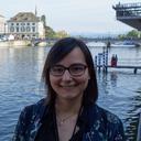
Nadine Biver: Nadine Biver is currently writing her master’s thesis to conclude her MSc degree in Geomatics at ETH Zurich. She specialized in cartography and GIS as well as planning. Her interests are in the fields of web cartography and visualizations for participatory planning processes. Within ETH’s Institute of Cartography and Geoinformation, Nadine works as a Student Assistant in the development of the MOOC "Introduction to Web Cartography”. In doing so, she gets to know novel teaching methods and she can share her passion and knowledge with people all over the world.